
Desert Online General Trading LLC
Dubai, United Arab Emirates
Desert Online General Trading LLC
Dubai, United Arab Emirates
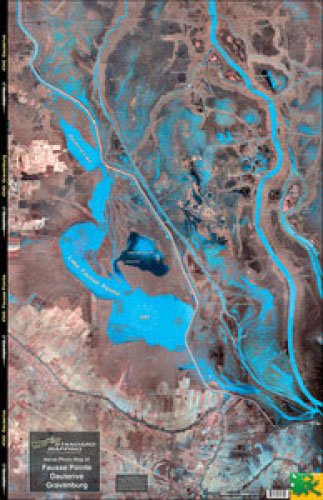
Standard Laminated Map Fausse Pt/Dautrieve/Gravenberg SM045 This satellite aerial photo map is the perfect tool for the fisherman or outdoor enthusiast. The high resolution satellite photo map allows the inshore fisherman to see more accurate detail and hidden spots than that of a traditional navigation chart. Backwater areas come alive in this map. Get to places most people don't know about!
ترست بايلوت
منذ يوم واحد
منذ أسبوعين